Draft flood maps for Greater Montreal show far more homes at risk
Over 15,000 buildings would be classified at risk of flooding

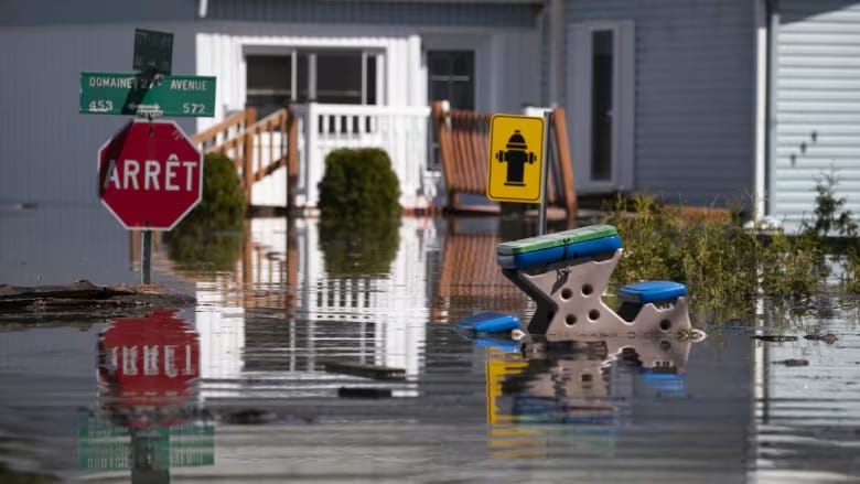
The number of properties in flood zones across Greater Montreal is projected to rise significantly, particularly in municipalities north of the island, according to the Communauté métropolitaine de Montréal (CMM).
The CMM, representing 82 municipalities in the Montreal region, adopted a preliminary report and unveiled a new flood map on Monday, in line with the Quebec government’s guidelines for flood risk assessment.
According to updated CMM flood maps, 15,508 buildings in Greater Montreal are now located in flood zones. This equates to 19,780 residences with a total property value of $9.9 billion, as noted by Nicolas Milot, CMM’s director of ecological transition and innovation.
Quebec last updated its flood zone maps in 2019 and plans to release new ones by spring 2025 as part of a revised flood-management plan.
Previously, Quebec categorized flood zones as either high-risk (with a 5% annual chance of flooding) or low-risk (1% chance). Under draft regulations, the province is now proposing a classification system with four levels of flood risk: very high, high, moderate, and low.
Flood risk is determined by two criteria: the likelihood of flooding in coming years and potential water levels.
Climate Change Expands Flood Zones
The expansion of flood zones in Greater Montreal can be attributed to three main factors, according to the CMM.
Firstly, the new maps incorporate data from significant flood events in 2017, 2019, and 2023.
Additionally, the Quebec government has mandated that flood zones must account for the uncertainties of climate change, which is expected to increase the frequency of flooding.
Finally, the maps now factor in the potential failure of flood-mitigation structures like dams and reservoirs. For example, Sainte-Marthe-sur-le-Lac, which saw a dike burst in 2019, has been classified as a flood zone for the first time.
Milot explained that while flood zones are expanding, the extent of this expansion varies across the region. It is less noticeable along the St. Lawrence River compared to areas like the Lake of Two Mountains, the Rivière des Mille Îles, and the Rivière des Prairies.
Notable areas with significant flood zone growth include Laval, riverside municipalities like Pointe-Calumet and Sainte-Marthe-sur-le-Lac in the MRC of Deux-Montagnes, Montreal’s Pierrefonds-Roxboro borough, and Vaudreuil-Dorion in Montérégie.
“In Greater Montreal, about 25 municipalities have to deal with a significant flood risk, especially in the spring,” Milot added.
In Laval, the number of flood-prone buildings is expected to increase from 1,100 to around 1,450, bringing the total to roughly 2,550 at-risk properties.
Province-wide, the draft regulations estimate that nearly 77,000 homes—around 2% of Quebec’s population—will be in flood zones, up from 22,000 today.
Impact on Property Value
Quebec’s regulatory analysis suggests that properties in very high-risk flood zones could see a 4% drop in value. However, Milot believes this estimate is too low.
“The issue with this assessment is that it only considers the regulation’s effect,” he explained. “There are other tools, policies, and programs that also impact property values.”
Quebec revised its financial aid program for flood victims in 2019, capping compensation at $100,000 per property for repeated floods. This limit has prompted some mortgage lenders, like Desjardins Group, to stop financing homes in high-risk flood zones.
In these areas, “either people will need to bear the risk of flooding themselves, or we will have to consider relocating them,” Milot said.
Jim Beis, mayor of the Pierrefonds-Roxboro borough, noted that the new flood maps would affect nearly 1,800 homes in his district, marking a 70% increase.
“People who were never included in the flood map will suddenly find themselves in it, which is very concerning,” Beis said.
Since 2017, Beis has called for permanent flood-protection structures to safeguard residents, but none have been implemented. He criticized the CMM for taking “the easiest way out” by presenting a map identifying zero-risk areas without proposing tangible solutions.
Quebec’s public consultation on its flood-management framework, which began in June, will conclude on Oct. 17.


